Gran Canaria rises from sea level to about 1,949 metres, while La Gomera reaches 1,487 metres at Alto de Garajonay. That altitude gap explains the whole winter hiking decision: one island gives you broad, dry mountain routes, while the other delivers wet laurel forest, steep ravines, and sudden cloud.
La Gomera is the better winter hiking island
For serious winter hiking, pick La Gomera. It has fewer easy shortcuts, but the trails feel wilder, quieter, and more varied. In one day, you can walk through misty laurel forest, cross a sharp ridge, and finish above a warm Atlantic valley. That range is exactly what makes the island useful in winter.
Choose Garajonay for forest, mist, and steady shade
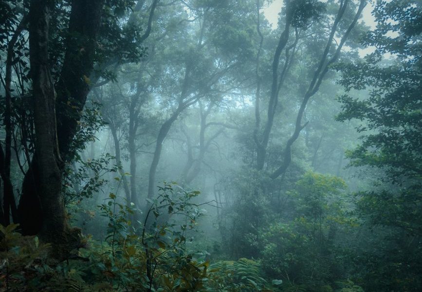
Garajonay National Park is the strongest starting point. The El Contadero to El Cedro route covers about 4.8 kilometres through laurel forest and the El Cedro ravine. Expect damp ground, slippery roots, and poor visibility when cloud settles over the ridge. The scenery is excellent, but this is not a casual walk in beach shoes.
Choose the south for warmer walking
When the high forest is soaked or hidden in cloud, move toward Valle Gran Rey, Chipude, or the lower ravines. The Chipude–Alto de Garajonay–Chipude circuit takes roughly 4 hours 10 minutes and reaches the island’s highest point. It combines exposed views, woodland, rural villages, and a long descent. My verdict is simple: use northern and central La Gomera for atmosphere, then drop south when you need sun and drier rock.
La Gomera and Gran Canaria suit different hikers
Do not choose between these islands by looking at beach temperatures. Choose by the kind of walking you want. La Gomera rewards hikers who like changing terrain and slower logistics. Gran Canaria works better for visitors who want a large menu of routes, easier road access, and dramatic viewpoints within a compact trip.
Route comparison at a glance
| Factor | La Gomera | Gran Canaria |
|---|---|---|
| Highest point | Alto de Garajonay, 1,487 m | Pico de las Nieves, about 1,949 m |
| Signature landscape | Garajonay laurel forest and deep ravines | Volcanic peaks, pine forest, and dry valleys |
| Short marked walk | Laguna Grande loop, 0.7 km, about 20 minutes | Roque Nublo access trail, short out-and-back |
| Strong intermediate option | Chipude–Alto de Garajonay–Chipude, about 4 hours 10 minutes | Highland routes around Tejeda and Cruz de Tejeda |
| Winter problem | Fog, wet roots, steep ravines | Wind, cold at altitude, busy access points |
| Best for | Quiet, immersive hiking | Route variety and easier transport |
Pick Gran Canaria for a first Canary Islands hiking trip
Gran Canaria is the more forgiving base for a mixed group. You can replace a cold summit walk with a lower coastal route without changing islands. The central mountains also offer plenty of viewpoints and villages close to main roads. The tradeoff is crowding around famous landmarks, especially Roque Nublo.
Pick La Gomera for a focused walking holiday
La Gomera wins when hiking is the reason for the trip, not one activity among ten. The island has more than 600 kilometres of signposted paths, but many involve serious climbs and awkward transfers. Book enough nights to absorb slow roads. Three full walking days is the minimum I would allow; five is better.
How winter weather changes the plan
Winter in the Canary Islands is not one weather system. It is a stack of small climates. A trailhead at 1,500 metres can sit in cloud while a valley 20 minutes away gets bright sun. Wind can turn a comfortable ridge into an unpleasant one, and rain on volcanic soil can create slick sections that stay dangerous after the sky clears.
Read altitude before reading the forecast
Start with elevation, not the temperature in your hotel town. Garajonay, Laguna Grande, Roque Nublo, and Pico de las Nieves can be several degrees colder than the coast. Pack for the summit conditions even if the morning begins in a T-shirt. A thin fleece, waterproof shell, warm hat, and dry spare layer cover most winter changes without adding much weight.
Use a three-check forecast routine
Check the forecast for the trailhead, the highest point, and the finish. Then check wind, rain, and visibility separately. A calm forecast at sea level tells you almost nothing about a ridge. Cancel exposed routes if strong wind combines with low cloud. Pick a lower ravine or village-to-village path instead. This is not wasted time; it is how you keep a good holiday from becoming a rescue problem.
On La Gomera, mist is part of the experience in Garajonay, but it also hides junctions and makes roots slick. On Gran Canaria, clear skies can be misleading because the high interior still feels cold. Winter hiking works best when you decide the route in the morning, not three weeks before departure.
How to build a safe three-day hiking plan
The smartest itinerary has one demanding day, one flexible day, and one low-risk day. That structure gives you room for cloud, ferry delays, sore legs, or a trail closure.
Day one: learn the island without burning your legs
- Walk a short route near your base and check how long transfers really take.
- Use the 0.7-kilometre Laguna Grande loop or another easy marked trail if you are in Garajonay.
- Buy water and food before leaving the main towns; rural trailheads may have no open shop.
- Save the emergency number 112 and tell someone your planned route and return time.
Day two: take the main route early
- Start before 9 a.m. so you have daylight for a slow descent.
- Choose the Chipude–Alto de Garajonay circuit on La Gomera, or a Tejeda-area highland walk on Gran Canaria.
- Turn around if visibility removes trail markers or wind makes exposed sections unstable.
Use day three for a lower trail, a village walk, or a route near the coast. If you plan Roque Nublo, check the current access system first because visitor reservations and access conditions can change. A reservation does not cancel the need to check weather, footwear, and daylight.
Mistakes that ruin Canary Islands winter hikes
The biggest failures are boring and preventable. People trust the coast forecast, underestimate descent time, or arrive at a famous trail without checking access rules. Fix those problems before leaving the accommodation.
Do not pack for the beach only
Shorts and trainers may work in a sunny coastal town and fail completely in Garajonay. Wet roots need shoes with real grip. A waterproof layer matters more than a heavy coat. Carry one litre of water per person for a moderate half-day route, then add more for heat, long transfers, or limited refill points. Food should include something salty and something easy to eat while moving.
Do not confuse a marked path with a simple path
Marked trails can still include steep steps, loose rock, narrow ledges, and confusing junctions. Download the route map before setting out. Keep the group together at forks. Avoid creating unofficial shortcuts, especially in protected forest. Those shortcuts damage roots and can leave you on unstable ground.
Never start a long route late because the morning looked bright. Winter daylight ends earlier than many visitors expect, and a delayed bus or slow climb can remove your safety margin. Also avoid planning a major hike immediately after a ferry crossing or a long mountain drive. Tired legs make descents clumsy.
The final choice: match the island to the hiking day
Choose La Gomera for the better walking experience. Its laurel forest, ravines, and quiet paths create more memorable days. Choose Gran Canaria if your group needs flexible route lengths, faster road access, or a trip that mixes hiking with city, beach, and village time.
Best La Gomera plan
Base yourself near Hermigua, Valle Gran Rey, or San Sebastián, then combine one Garajonay forest walk, one summit or ravine route, and one lower coastal day. Keep the summit day flexible. If cloud covers Alto de Garajonay, descend rather than forcing the view. The forest is still worthwhile in mist, but exposed ridges are not.
Best Gran Canaria plan
Stay near Las Palmas for easy transport and use one early day for Roque Nublo, one for the Tejeda highlands, and one for a lower route such as a coastal or ravine walk. This plan gives you an escape when the central mountains are cold, windy, or crowded. It also avoids treating one landmark as the whole island.
The most important takeaway is simple: for winter hiking in the Canary Islands, choose La Gomera for immersive trails and Gran Canaria for flexible mountain access, then let the altitude forecast decide each day.