

Most Queensland drivers use the RACQ Trip Planner the same way they use Google Maps — type in a destination and go. That leaves a lot on the table. RACQ’s planning tools cover live fuel prices, road condition alerts, member discounts, and route data that general mapping apps don’t carry. But there are real gaps too, and knowing them before you leave Brisbane matters considerably more than figuring them out somewhere west of Charleville.
Here’s a practical breakdown of how to get the most from RACQ’s road trip tools, which Queensland routes they handle best, and where you’ll need to pull in something else entirely.
What RACQ’s Trip Planner Actually Covers
The RACQ Trip Planner is a web-based route tool available through the RACQ website. It generates turn-by-turn directions, estimated fuel costs, and travel times — baseline functionality shared with Google Maps. What separates it is the Queensland-specific data layered underneath.
RACQ integrates live fuel price data from its own statewide monitoring network across Queensland service stations. It flags road closures and conditions using Queensland Department of Transport and Main Roads feeds. For members, it also surfaces discount fuel locations and suggested stops linked to RACQ-approved accommodation and travel partners.
Here’s how the main planning tools compare side by side:
| Feature | RACQ Trip Planner | Google Maps | WikiCamps Australia | Hema Explorer |
|---|---|---|---|---|
| Turn-by-turn directions | Yes | Yes | No | Yes |
| Live Queensland fuel prices | Yes | No | No | No |
| Road condition alerts | Yes | Limited | No | User-reported |
| Free campsite data | No | No | Yes | Partial |
| RACQ member discounts | Yes | No | No | No |
| Offline use | Limited | Yes (downloaded maps) | Yes | Yes |
| 4WD track ratings | No | No | Partial | Yes |
| Roadside assist integration | Yes | No | No | No |
The verdict is straightforward: RACQ wins on Queensland fuel price data and road condition monitoring. Google Maps wins on real-time traffic and offline reliability. For anything leaving sealed roads, you’ll need WikiCamps Australia or Hema Explorer running alongside it — RACQ alone won’t cut it.
How to Set Up a Route in the RACQ Planner
Go to racq.com.au, navigate to the Travel section, and open the Trip Planner. Enter your start and end points. The tool returns a suggested route, estimated travel time, and a fuel cost estimate based on vehicle type. You can add multiple intermediate stops. One important adjustment: change the default fuel consumption figure. The planner defaults to 10L/100km, which understates real consumption for anyone towing a caravan or driving a loaded 4WD. A 200-series LandCruiser towing will realistically use 18–22L/100km. Enter your actual figure or the cost estimate is meaningless.
The Road Conditions Layer Is the Most Underused Feature
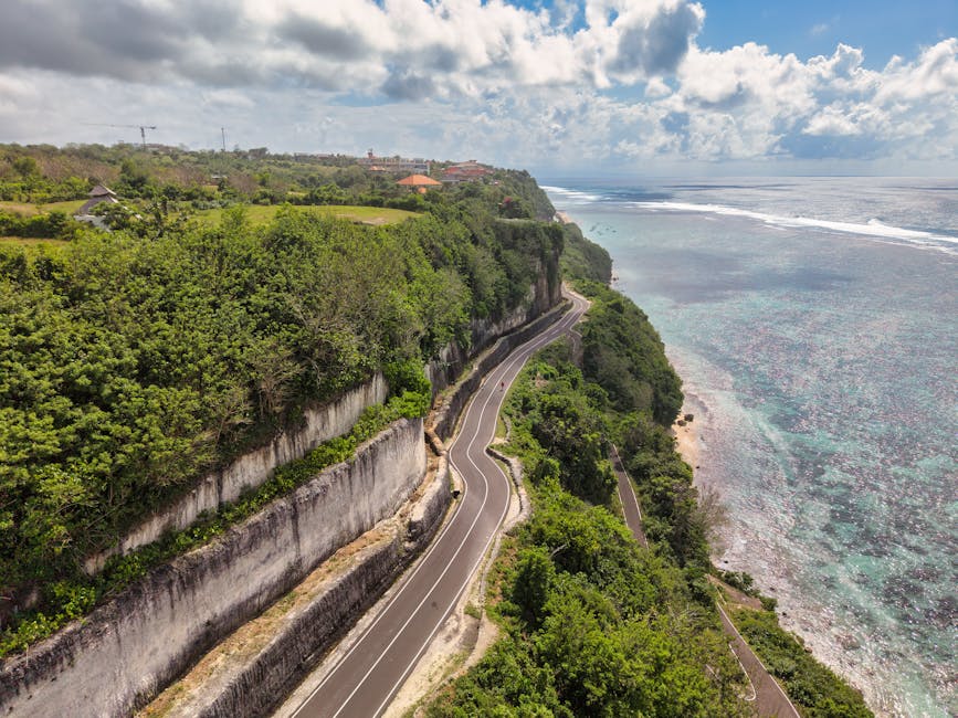
Queensland manages over 33,000km of state-controlled roads — the largest network of any Australian state. A significant portion of outback and Cape York routes flood, wash out, or close with no advance warning. The RACQ planner connects to Queensland Traffic data and flags active closures directly on your route. Check this 24–48 hours before departure for any outback leg, not just at the booking stage. Road status after rain in western Queensland can change within hours. This single feature has more practical value than anything the planner’s competitors offer for Queensland-specific driving.
RACQ Member App vs. Web Planner
The RACQ member app (iOS and Android) handles roadside assist callouts, fuel price searches near your location, and basic account management. It is not a full trip planner. The web planner doesn’t have a dedicated mobile app counterpart — you’re using it in a phone browser. That’s fine for pre-departure planning at home. On the road, it’s impractical. Mobile data coverage drops off sharply west of the Great Divide. Plan your route with RACQ’s web tool at home, export the waypoints or note your stops, then navigate with Google Maps offline downloads or a dedicated Garmin GPS unit once you’re moving.
Five Queensland Drives That Work Well With RACQ’s Tools
These five routes get the most out of RACQ’s planning layer — multiple fuel stops where price monitoring saves money, sealed roads where condition alerts matter, and distances long enough that the membership cost pays for itself.
- Brisbane to Cairns via the Bruce Highway — 1,703km, roughly 18–20 driving hours split across three or four days. The Bruce is Queensland’s main artery, and fuel prices vary noticeably between the Sunshine Coast, Mackay, Townsville, and Cairns. RACQ’s monitoring consistently shows a $0.15–$0.25 per litre spread across the route depending on the week. Fill the tank at Townsville rather than small servo towns further north — competition drops and prices rise past Cardwell.
- Brisbane to Longreach via the Warrego Highway — 1,176km, about 12 hours. This is RACQ’s strongest use case: outback Queensland, genuine fuel stop planning, and variable road conditions after rain. Fuel at Roma and Charleville rather than the towns between them. Longreach sits at the end of a long flat run through Mitchell grass country — the route is straightforward but cattle wandering onto roads after dark is a consistent hazard from dusk onward.
- Sunshine Coast Hinterland Loop — 250–300km over a day or weekend, covering Maleny, Montville, Kenilworth, and Noosa. No outback risks. RACQ member accommodation discounts are genuinely useful here — several Hinterland guesthouses and motels participate in RACQ’s preferred partner program, knocking $15–$30 off nightly rates.
- Gold Coast to Lamington National Park via Scenic Rim — 120km one way. Short drive, but RACQ’s road condition alerts are the main reason to use the planner here. The access roads through Canungra and up to O’Reilly’s Rainforest Retreat close after heavy rainfall — sometimes the same afternoon as a storm. Checking conditions that morning is not optional if you’re travelling after rain.
- Townsville to Mount Isa via the Flinders Highway — 908km, about 9.5 hours of continuous driving. One of Australia’s most exposed stretches: extreme heat from October through March, long gaps between towns, and essentially no phone coverage for extended sections. RACQ Roadside Assistance is not optional on this route. Average daytime temperatures exceed 38°C in summer. Check fuel at Cloncurry, carry extra water, and don’t attempt it in a vehicle with known mechanical issues.
Cape York Peninsula and Fraser Island are different categories entirely. The RACQ online planner is a useful starting point for logistics, but Hema Explorer’s 4WD-rated track maps and current condition reports from Queensland National Parks are mandatory additions before those trips.
RACQ Fuel Finder: The Feature That Pays for Membership on Long Drives
Queensland fuel prices are not uniform, and they don’t move randomly. In southeast Queensland, petrol prices follow a predictable 7–10 day cycle from trough to peak. Understanding where you sit in that cycle before a long drive saves real money — not life-changing amounts, but consistently $15–$30 on a full-tank road trip. RACQ’s fuel price monitoring is the clearest way to track it without obsessively checking a dozen individual station apps.
How the RACQ Fuel Price Tool Works
The tool lives at racq.com.au under Cars and Driving, then Fuel Prices. It shows current average petrol and diesel prices broken down by Queensland region, updated regularly throughout the week. RACQ also sends fuel price email alerts for members who opt in, notifying you when Brisbane prices hit cycle lows. The underlying data isn’t a per-station live feed — it’s aggregated monitoring data — but it’s accurate enough to tell you whether today is a cheap day to fill up before hitting the highway or whether waiting 48 hours will save $0.12 per litre on a 70-litre tank.
Where Outback Fuel Pricing Gets Expensive
Remote Queensland has no meaningful fuel price competition. Birdsville, Windorah, and Bedourie consistently run $0.40–$0.60 per litre above Brisbane prices. That’s not inefficiency — it reflects the cost of trucking fuel several hundred kilometres from the nearest distribution point. RACQ’s planner flags these areas but can’t change the economics. Budget for it explicitly. A 70-litre fill in Birdsville in 2026 costs roughly $160–$175 compared to $115–$125 in Brisbane. For a diesel 4WD towing at 22L/100km over the full Longreach route, total fuel spend one-way runs $480–$540 depending on timing and where you fill.
Diesel vs. Petrol: Different Monitoring Needed
Diesel pricing doesn’t follow the same 7–10 day Brisbane cycle that petrol does. RACQ’s fuel report tracks both separately, which matters for the significant number of Queensland road trippers driving diesel 4WDs or towing caravans. Diesel is generally more price-stable in the southeast but proportionally more expensive in outback towns than petrol on a cents-per-litre basis. If you’re driving a diesel HiLux or LandCruiser, check the diesel average specifically — don’t assume it mirrors the petrol cycle you’ve read about.
What Roadside Assist Actually Covers in Remote Queensland

Standard RACQ Roadside Assistance covers breakdowns on sealed and gazetted roads. Off the highway grid — dirt roads, station tracks, creek crossings — you need RACQ’s Premium Care tier or the Extra Care add-on, which extends to locations only accessible by 4WD or requiring long-distance towing beyond standard recovery limits. The distinction is critical between Cooktown and the tip of Cape York, where a tow from a remote location without adequate coverage can exceed $2,500 out of pocket. Read the Product Disclosure Statement for your specific membership tier before you depart. Don’t assume. Tier names have changed over the years and what was covered under a past membership may differ from current inclusions.
Where RACQ’s Planner Genuinely Falls Short

RACQ built its planning tools around Queensland’s sealed road network and standard passenger vehicles. The weaknesses surface quickly in three specific situations.
Does It Handle 4WD and Off-Road Routes?
No — and this is the biggest gap for adventurous Queensland driving. The RACQ Trip Planner doesn’t distinguish between sealed highway and 4WD-only tracks. It won’t flag that the direct approach to Cape Tribulation via the Daintree Ferry requires a high-clearance 4WD after rain, or that the Old Telegraph Track on Cape York is rated Extreme and destroys vehicles driven by people who misread its difficulty. For off-road Queensland, Hema Explorer at $49.99 per year for the app subscription is the right tool. It includes detailed track difficulty ratings, water crossing depth data, and community-submitted condition reports updated in near real-time during peak 4WD season. Use RACQ for the highway legs and Hema for anything else.
What Happens When You Cross the State Border?
RACQ’s trip planner technically routes interstate trips on major highways — Brisbane to Sydney, Brisbane to Melbourne. The Queensland-specific data layers disappear past the border. NSW road condition data defaults to Transport for NSW feeds, which RACQ doesn’t fully integrate. For drives continuing into NSW, NRMA’s tools carry more relevant regional data. For South Australia and Western Australia outback travel, RAA and RAC respectively have better local coverage. Importantly, RACQ Roadside Assistance maintains full reciprocal benefits with all state motoring clubs, so your assist coverage stays active nationwide — the planning data quality is what drops, not the on-road protection.
Can You Use It Without Phone Coverage?
Not reliably. The RACQ web planner is browser-based with no meaningful offline mode. The member app has limited cached data but won’t generate or re-route trips without a data connection. For any Queensland drive that passes through areas with no Telstra coverage — and large sections of outback Queensland, Cape York, and western ranges fall into this category — plan your full route at home, screenshot or print turn-by-turn directions for each leg, and use Google Maps with pre-downloaded offline maps as your navigation backup. Alternatively, a Garmin dēzl or similar dedicated GPS unit with Australian maps loaded locally eliminates the connectivity dependency entirely. RACQ’s tools are best understood as pre-departure planning resources, not live navigation systems.
The road trip planner works best when you treat it as exactly that — a planning tool, not a navigation app. Use it the night before to check road conditions, scout fuel stops, and calculate realistic travel times. Then close the browser, load Google Maps offline, and drive.


